‘Don’t Amputate-Renovate’ is a series curated by Hidden Architecture where we conduct a work of recovering and archiving of buildings demolished in New York before the creation of the New York City Landmarks Preservation Commission in April 1965 after the demolition of the Pennsylvania station. The archivist work of this series attempts to show a critical position against new possible acts of vandalism against the architectural heritage in the rest of the world. The name ´Don’t Amputates-Renovate´ is a tribute to the rallies realized in the 1960s attempting to stop the demolition of the typical train station. All the articles of this series have the same narrative organization: location, the historical context during its construction, architectural qualities of the building, demolition, and current situation of the site.
‘Don’t Amputate-Renovate’es una serie comisariada por Hidden Architecture donde realizamos un trabajo de recuperación y archivo de los edificios demolidos en Nueva York antes de la creación de la Comisión para la Preservación de Monumentos Históricos de Nueva York en Abril de 1965 tras la demolición de la estación de Pensilvania.. La labor archivista de esta serie es mostrar una posición crítica frente a probables nuevos actos de vandalismo contra el patrimonio arquitectónico en el resto del mundo. El nombre ‘Don’t Amputate-Renovate’ (No Amputes – Reueva) proviene de las manifestaciones que se realizaron para evitar la demolición de la mítica estación de trenes. Todos los artículos de la serie tendrán la misma organización narrativa: localización, contexto histórico en su construcción, cualidades arquitectónicas del edificio, demolición y estado actual de lugar.
*** Demolished (1955) ***
LOCATION | LOCALIZACIÓN
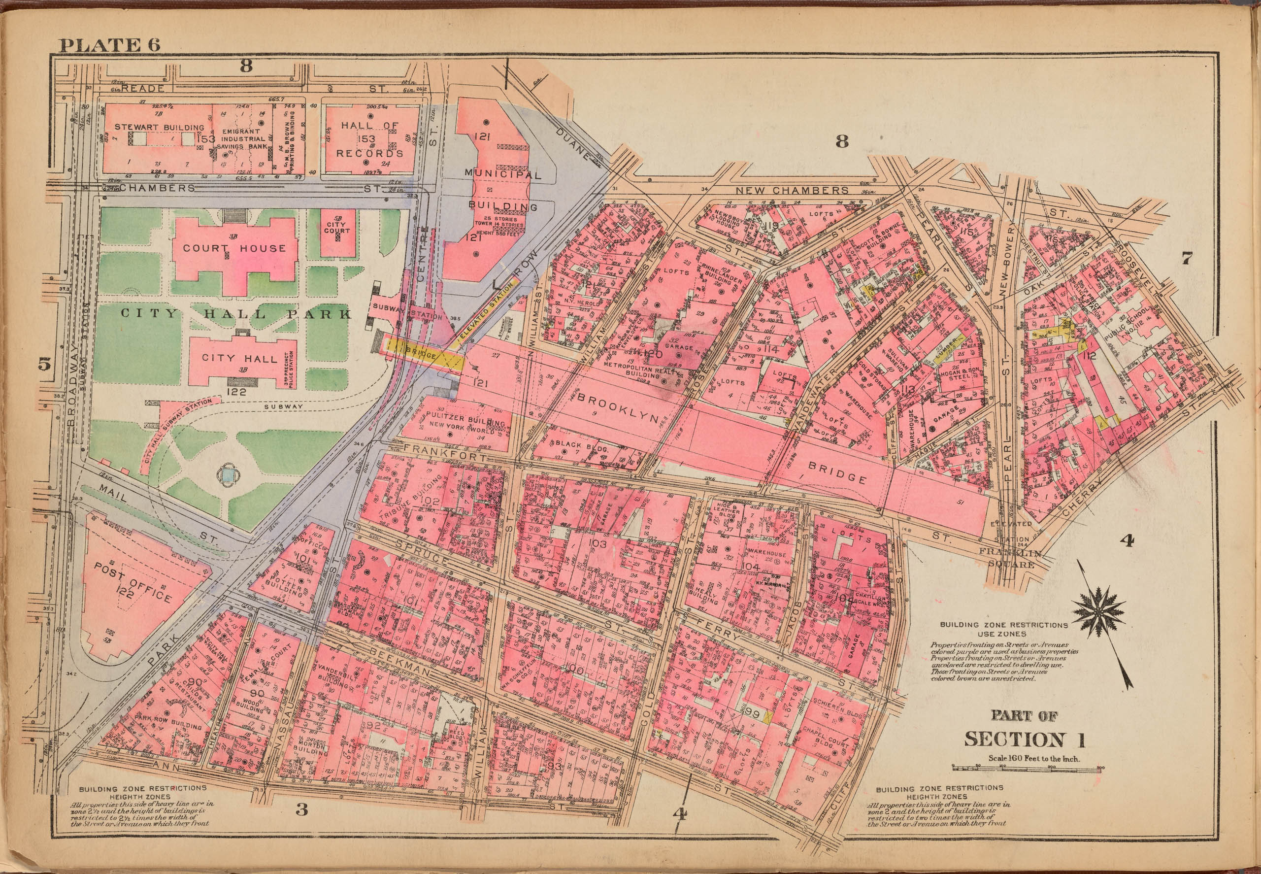
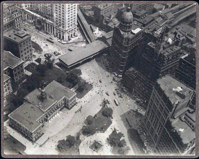
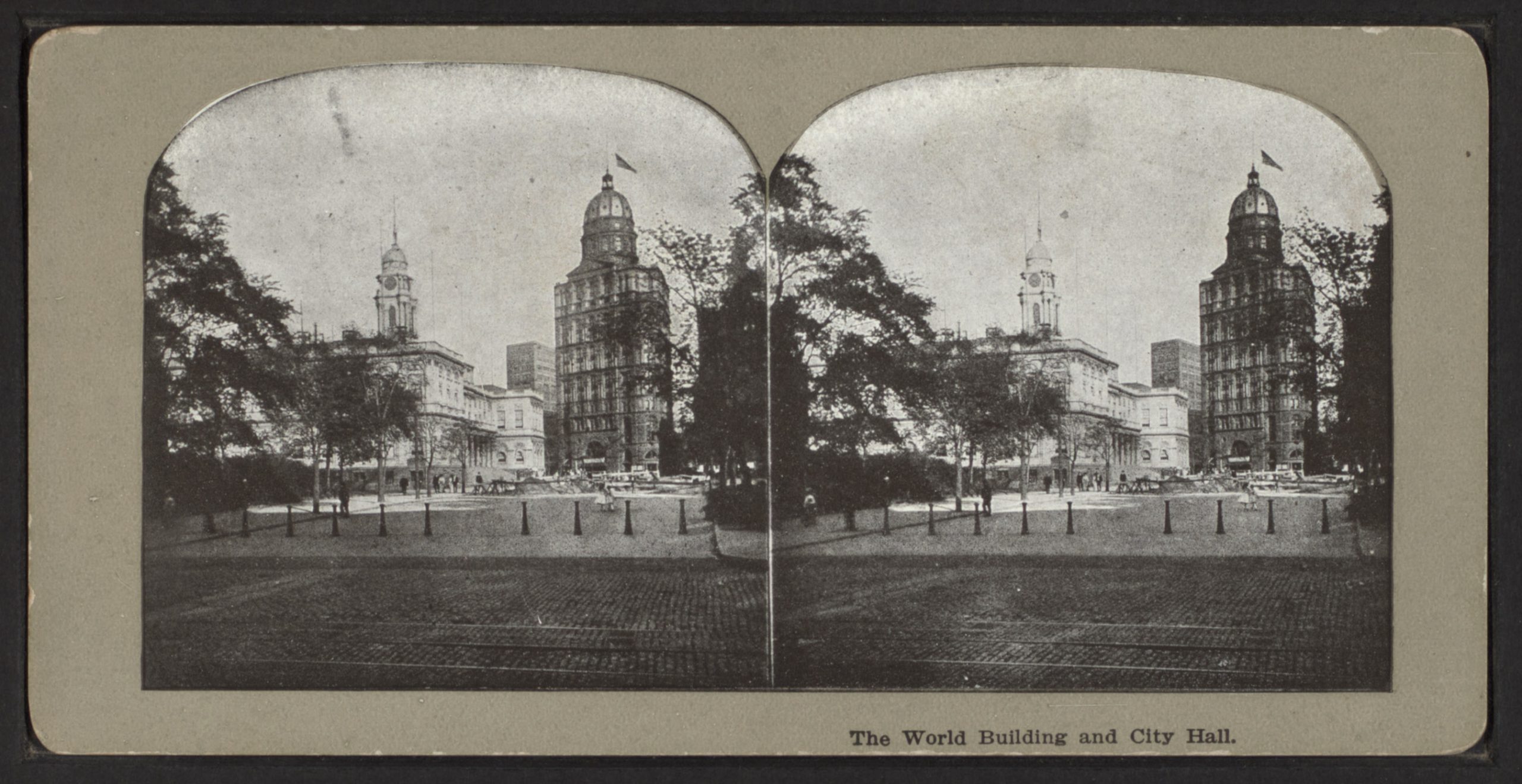
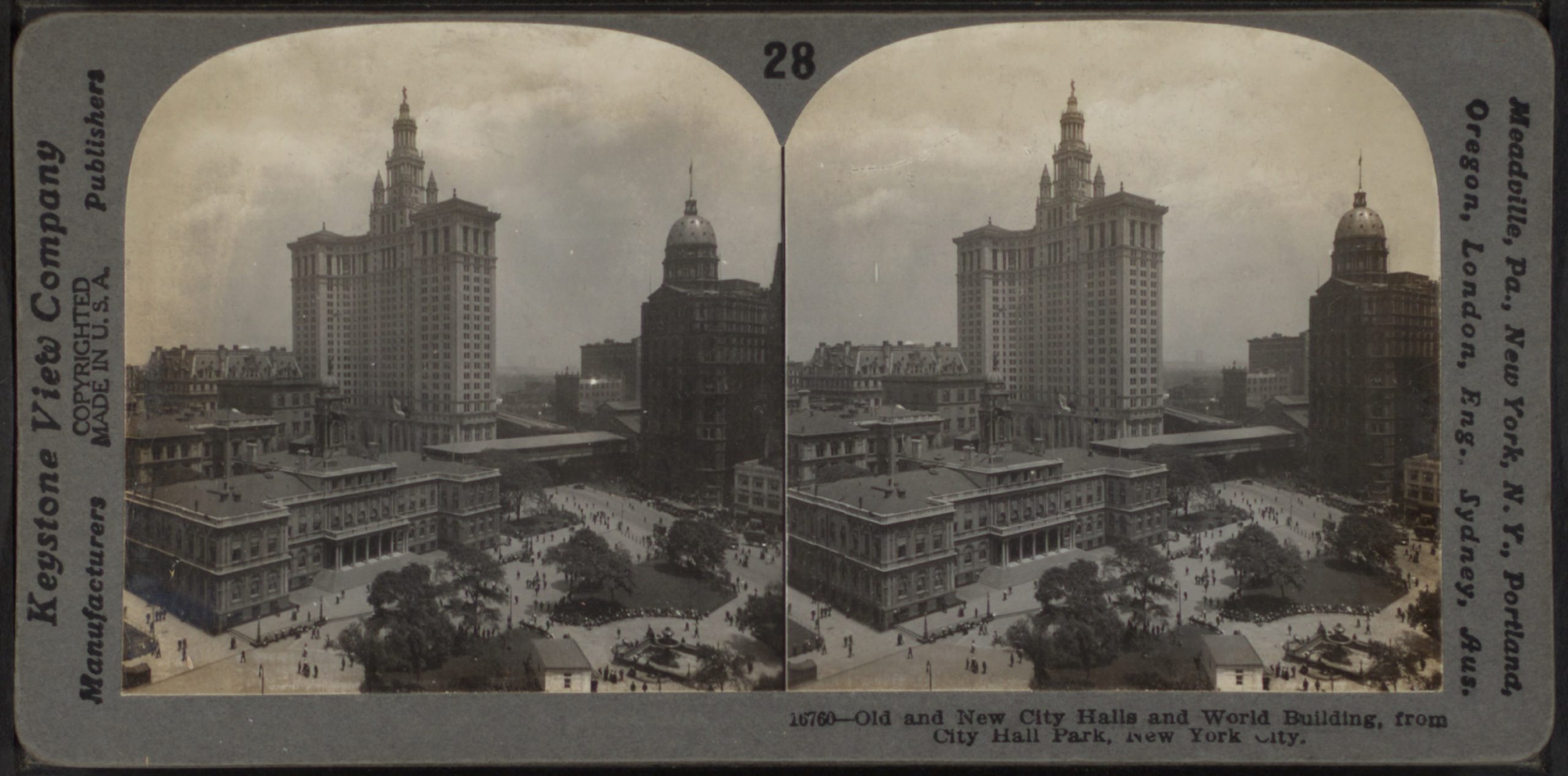
The building was located on 61-63 Park Row in downtown Manhattan. It was delimited on the south by the park that hosted the City Hall, the subway station and the Court House, the Brooklyn Bridge to the North – and an elevated station that was later demolished. Beyond the bridge, the Municipal Building, with its 25 floors, had a strong presence. On the south, the New York World Building was the limit or a dense urban fabric continuing until the waterfront. Therefore, the site’s condition was unique since it was the vortex of three different urban realities: the density of the downtown, the monumentality of the institutional buildings, and the infrastructural scale of the Brooklyn Bridge.
El edificio estaba localizado en los números 61-63 de la avenida Park Row, en el downtown de Manhattan. El solar estaba delimitado por el parque que acogía al edificio del ayuntamiento, su estación subterránea y el edificio de la corte al este; el Puente de Brooklyn al norte – y una estación elevada que ya ha sido demolida. Más allá del puente, se encontraba el Edificio Municipal que con sus 25 alturas, imponía su presencia en el entorno. El edificio del New York World era el límite de una densa fábrica urbana que se extendía hacia el sur. Por tanto, la condición del solar era única ya que era un lugar de conexión entre 3 realidades urbanas: la densidad del Downtown, la monumentalidad de los edificios institucionales y la escala infraestructural del Puente de Brooklyn.
HISTORICAL CONTEXT | CONTEXTO HISTORICO

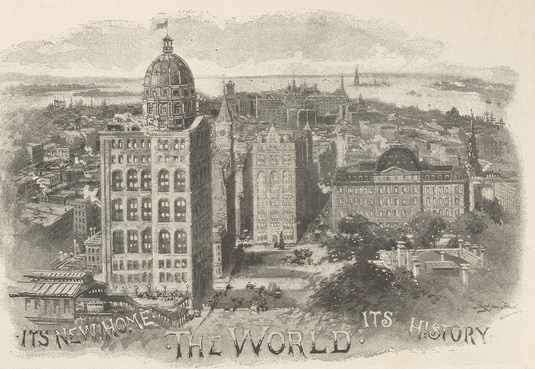
New York World was a newspaper active from 1860 to 1931. It was a progressive and sensationalist journal, closed to the Democratic Party. In 1883, Joseph Pulitzer bought the paper, relaunched its sales connecting with the working and immigrant classes of the city, and managed to overtake the circulation of the New York Times and the New York Tribune. In 1988, he bought s lot of Park Row to build the new headquarters that would be finished in 1890 and would become the tallest building of the city for five years. Its location was strategic from commercial and political views. At that time, the principal city newspapers had its headquarters on the same street: first the New York on the 41 Par Ro (1858), then the Tribune (1870), New Yorker Staats-Zeitung, the Times again in 1889 in a building that triple its number of floors, and finally, the New York World in 1990. The reason for the newspapers to be located on Par Row was its proximity to the City Hall and the Court building, allowing them closer proximity with political power.
New York World fue un periódico, cercano al partido demócrata, y de corte progresista y sensacionalista que estuvo activo desde 1860 hasta 1931. En 1883, Joseph Pulitzer compró el periódico y relanzó sus ventas conectando con las clases trabajadoras e inmigrantes de la ciudad consiguiendo superar en números de ejemplares al New York Times y al New York Tribune. En 1988, adquirió el solar de Park Row para construir su nueva sede que estaría terminada para 1990 y se convertiría en el edificio más alto de la ciudad durante un lustro. La localización elegida era estratégica desde el punto de vista comercial y político. En aquella época los grandes periódicos de Nueva York estaban localizados en la misma calle, primero el edificio del New York Times en el número 41, (1858), más tarde el Tribune (1870), el New Yorker Staats-Zeitung (1873), nuevamente el Times en 1889 con un edificio que triplicaba su altura y finalmente el New York World en 1990. La razón para la aglomeración en esta zona de Manhattan era su proximidad al ayuntamiento y al edificio de la corte lo que le permitía una mayor proximidad con el poder político.
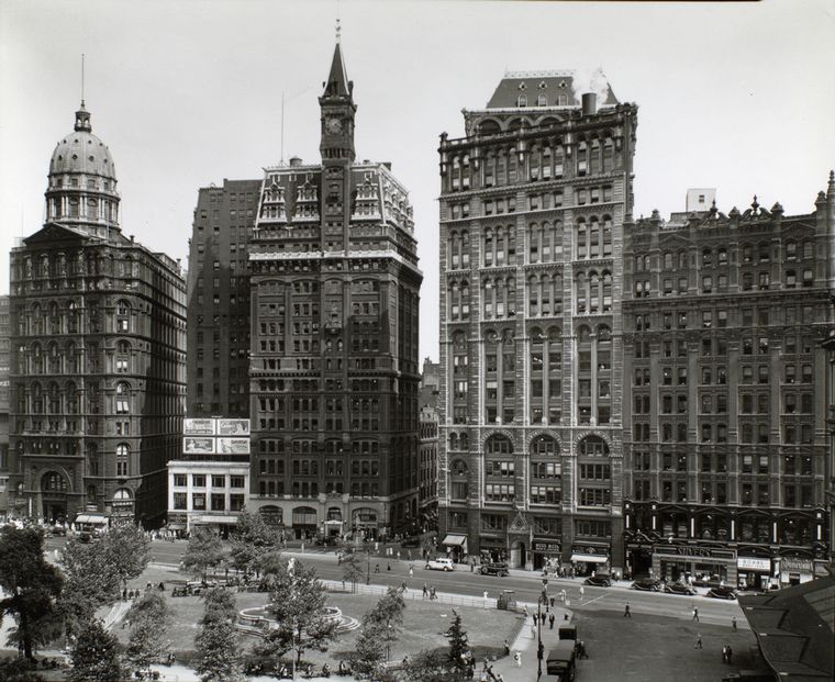
Within this context, the New York World achieved a double success with the office tower: first, it was able to build the city’s tallest building. Moreover, it got the dominant position of the new urban skyline of the city. Its location, marking the end of the urban fabric and next to the bridge, allowed its dome to stand out and frame the rest of the newspaper buildings. These achievements were notorious since the inauguration of the building since it congregated the political power from New York and Washington.
Dentro de este contexto, el New York World consiguió un doble éxito con su nueva torre de oficinas: por un lado fue capaz de construir el edificio más alto de la ciudad y por otro, tener una posición predominante dentro del prematuro skyline urbano del sur de la ciudad. Al estar localizado al lado del puente, su cúpula destacaba en el perfil de la ciudad y enmarcaba la esquina de la plaza. Este logró fue notorio durante su inauguración ya que fue capaz de congregar a importantes políticos de Nueva York y Washington.
ARCHITECTURAL FEATURES | CUALIDADES ARQUITECTÓNICAS
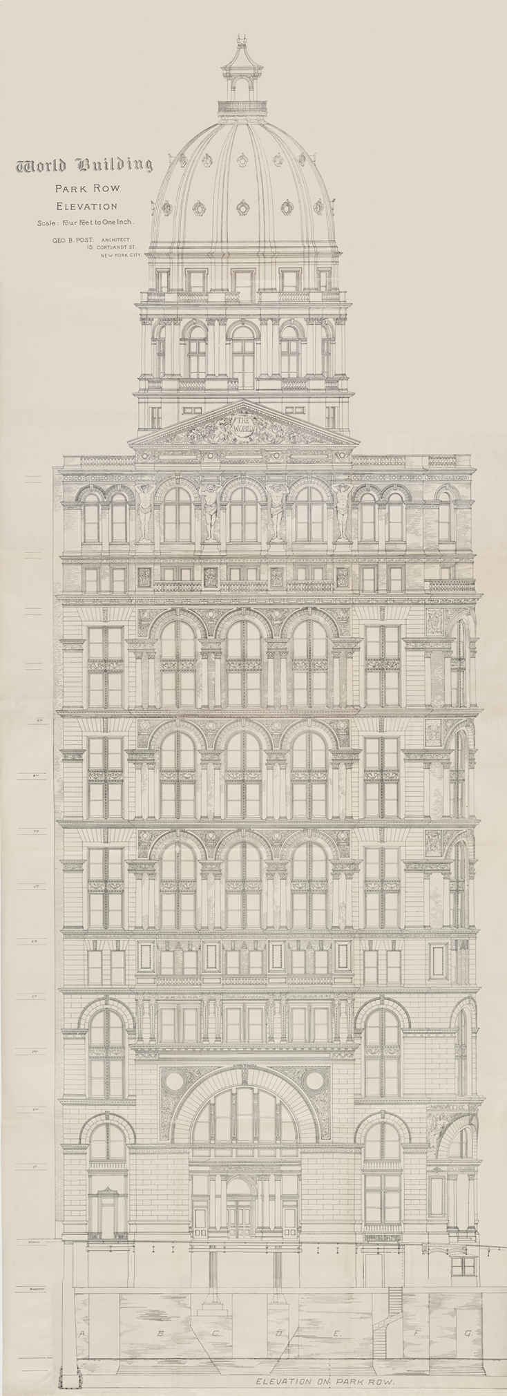
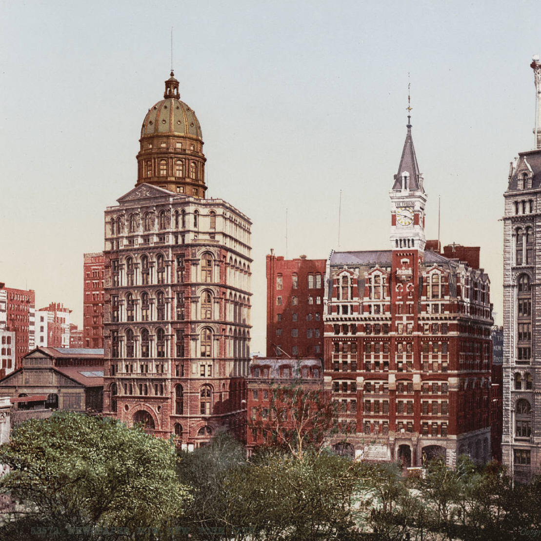
The volume of the New York World building is an extrusion of the lot without any setback until it reached the dome. When the building was designed, the 1916 Zoning Resolution was not yet created; the technical and economic factors just limited the height or setbacks of the buildings. Downtown Manhattan with its narrow streets, similar to a European City Centre, and tall buildings are the result of the lack of regulation during the end of XIX and the beginning of XX centuries.
La volumetría del edifcio New York World destaca por la extrusión de la parcela sin ningún retranqueo hasta llegar a su cúpula. En 1889, aún no se había creado ninguna normativa que limitara la altura de los edificios o les obligara a retranquearse de la calla a partir de cierta altura (aparecería un cuarto de siglo más tarde con la Ley de Zonificación de 1916) por lo que las primeras torres de la ciudad ascendían todo lo que las delimitaciones técnicas y económicas les permitieran. El sur de Manhattan con sus calles similares al de una centro histórico europeo pero con torres de más de 15 alturas es el resultado de la falta de regulación de los últimos años del siglo XIX y primeros del siglo XX.
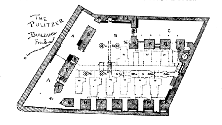
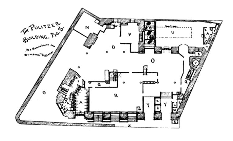
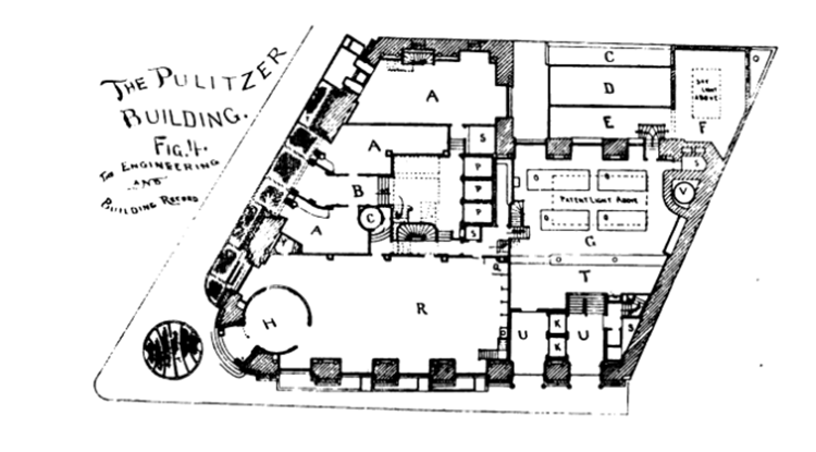
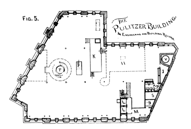
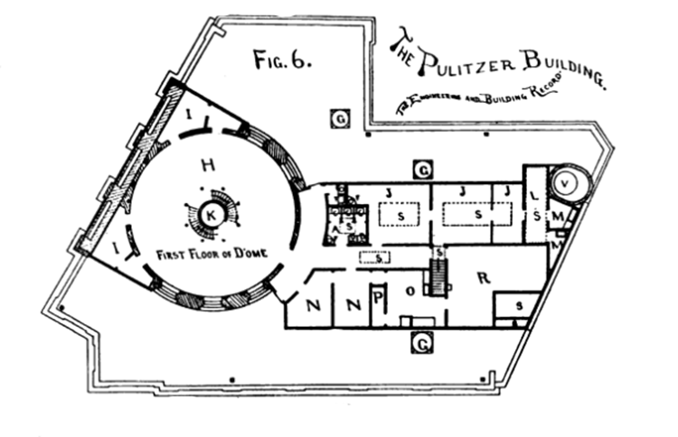
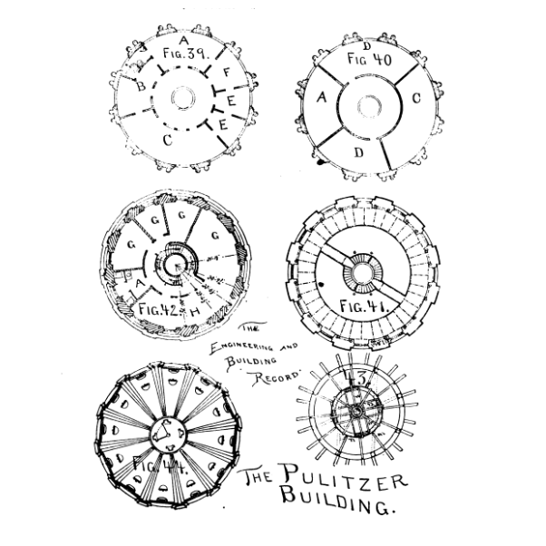
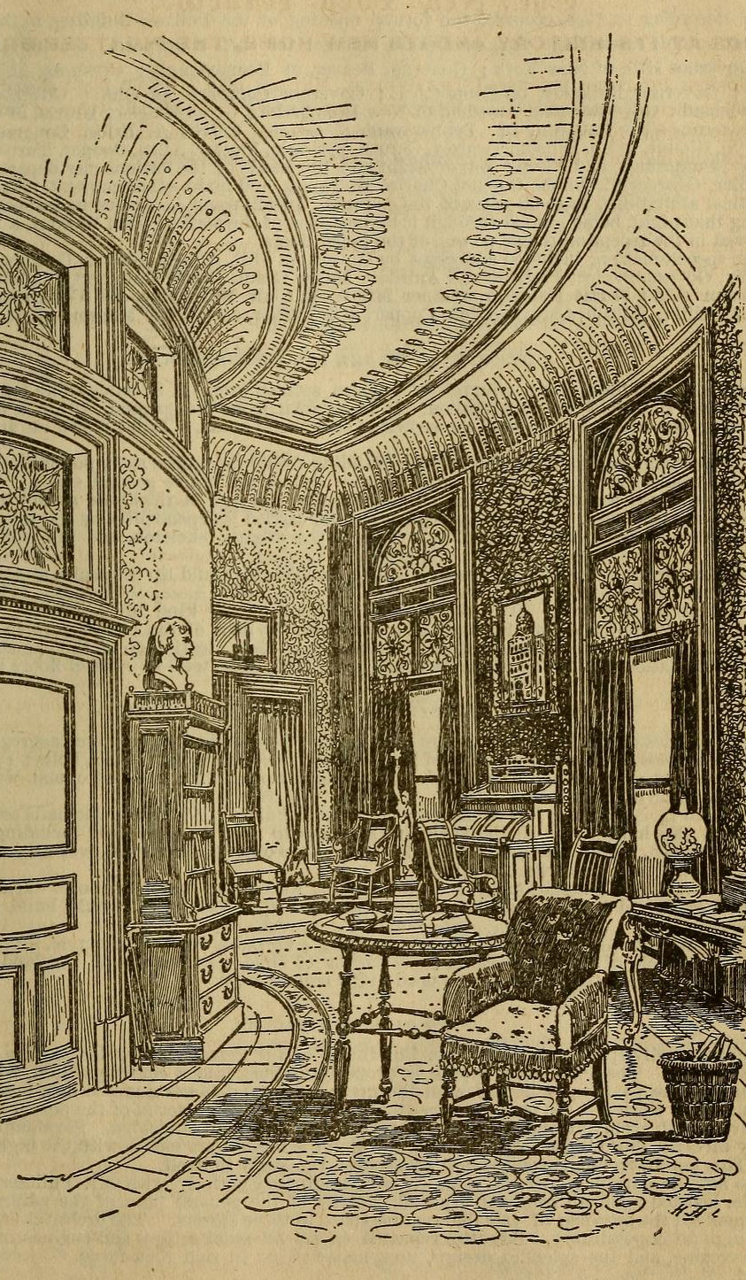
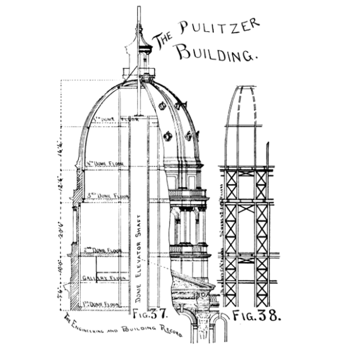
From a programmatic view, the George B. Post project worked as a newspaper production vertical machine, and it had a working hierarchies stratification. Joseph Pulitzer’s office occupied the dome. The journalists used the levels below the dome. Other employees used the rest of the levels until the basement where the printing machines were located.
Desde el punto de vista programático, el proyecto de George B. Post funcionaba como una máquina vertical de producir periódicos usando una estratificación de jerarquías laborales. En la cúpula estaba el despacho del propio Pulitzer. Según se iba descendiendo, se iban localizando las mesas de redacción de los periodistas y otros empleados que hacían posible el periódico hasta llegar al sótano donde se localizaban las máquinas de imprenta.
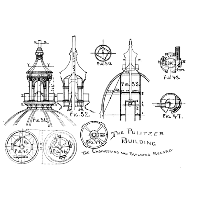
The facade was designed following the principles of the Beaux-Arts architectural style. It was the dominant architecture in New York at that time: different sizes windows framed by classic columns fragmented its volume and visually reduced its size. The dome, in a golden color, offered a distinctive tone to the surrounded buildings. La fachada está proyectada siguiendo los principios estilo arquitectónico Beaux Arts, dominante en Nueva York durante el cambio de siglo: ventanas de distintos tamaños enmarcadas por columnas clásicas fragmentan su volumetría y reducen visualmente su tamaño. La cúpula, de color dorado, ofrece un elemento distintivo frente a los edificios de su entorno.
DEMOLICIÓN | DEMOLITION
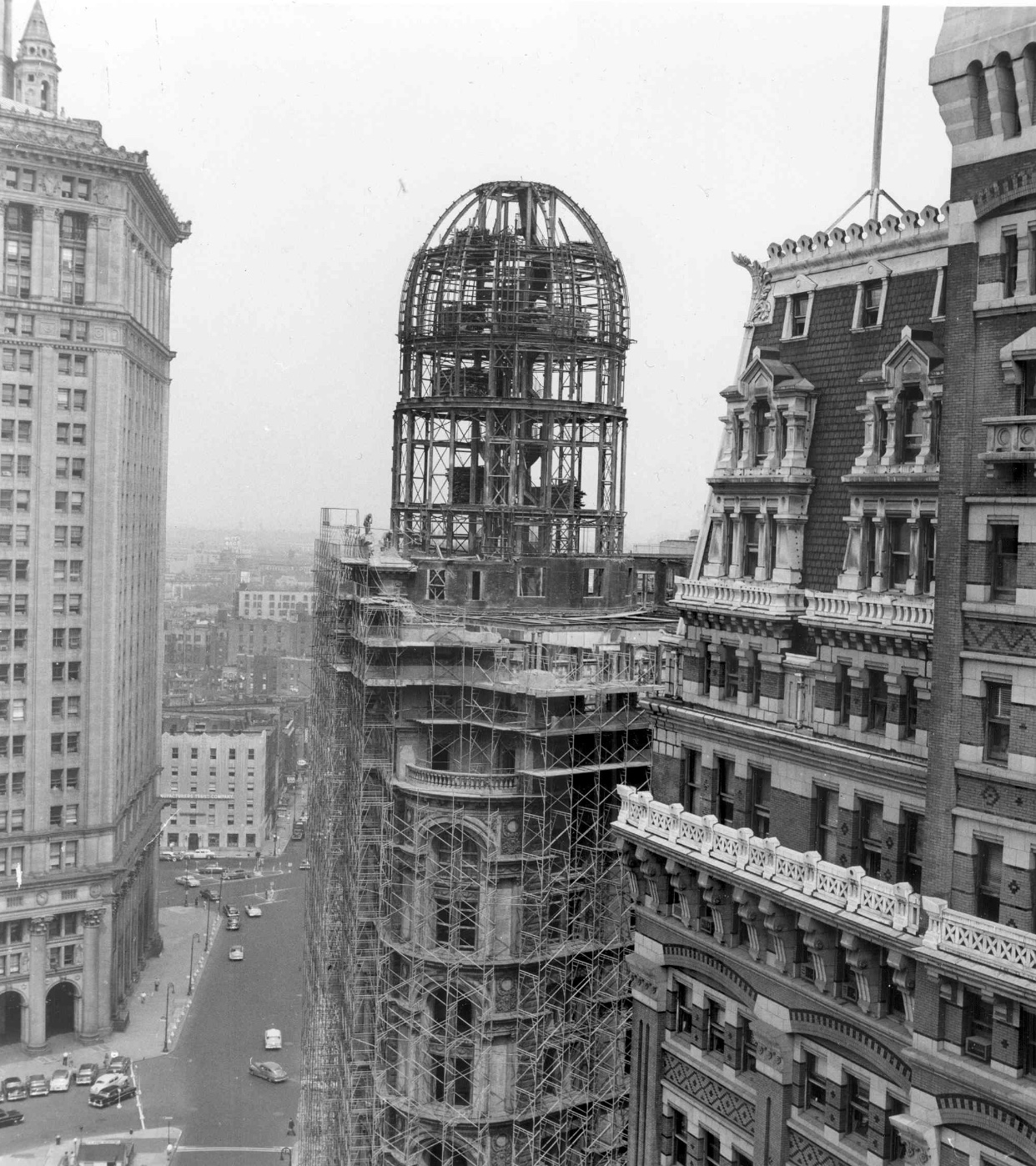
Joseph Pulitzer passed away in 1911. In 1931, his sons and inheritors sold the paper to the E. W. Scripps Company that merged with The Evening Telegram. Nonetheless, the family decided to keep the building. At the end of the 1930s, the city started to prepare a plan to enlarge the car exit of the Brooklyn Bridge that would force to demolish the New York World Building, among others. This plan had an impact on the city budget, so it was postponed for two decades until 1952 when it was officially approved. The New York World building was finally demolished in 1955.
Joseph Pullitzer falleció en 1911. En 1931 sus hijos y herederos vendieron el periódico a la compañía E. W. Scripps que lo terminó fusionando con The Evening Telegram, pero la familia decidió mantener el edificio. A finales de la década de los años 30, la ciudad comenzó a preparar un plan para ampliar la salida de automóviles del puente de Brooklyn lo que obligaría a demoler el edifico del New York World entre otros. Este plan debido al alto coste para la ciudad quedó en suspense durante dos décadas hasta 1952 que fue recuperado por las instituciones. El edificio New York World sería demolido finalmente en 1955.
CURRENT SITUATION | ESTADO ACTUAL
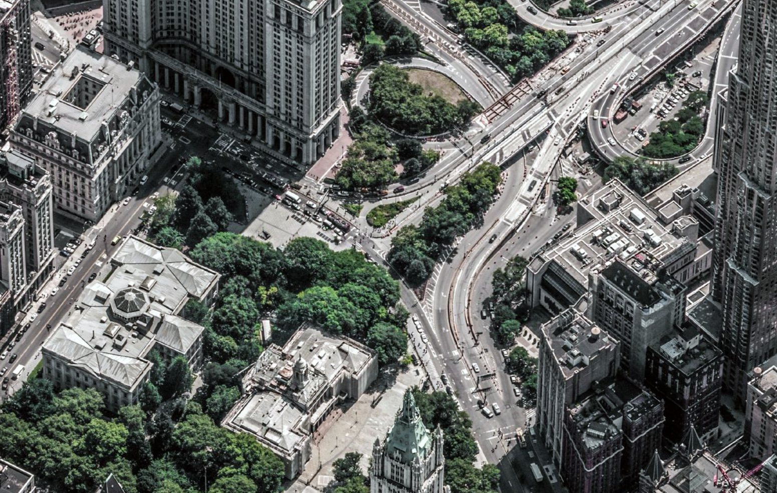
Currently, the area around Park Row is a strange place where different realities and scales come together without any continuity between them. The city hall park, formerly crucial for its neoclassical monumentality and open character to the city, has been completely cornered by a building density that continues to grow vertically without a clear concept. This urban space, isolated by the traffic around, is hardly used to provide better views to the skyscrapers that frame it. Cars that drive through the Brooklyn Bridge primarily congest this area. The car ramps, built in the 1960s, partially flow into the town hall square, collapsing the adjacent streets. This congestion is increased by the thousands of people and cyclists who cross it every day through its central street and end at the same point as road traffic. The result is an unconnected patchwork of urban situations. This situation is caused by Manhattan’s space problems and the lack of flexibility that its rapid growth has offered.
Actualmente, el área contigua a Park Row es un lugar extraño donde confluyen varias realidades y escalas sin ningún tipo de continuidad entre ellas. El parque del ayuntamiento, antiguamente importante por su monumentalidad neoclasicista y carácter abierto en relación a la ciudad, ha sido totalmente arrinconado por una densidad edificatoria que sigue creciendo verticalmente sin un concepto claro. Este espacio que en su momento debió ser un nodo urbano para Manhattan, ahora rodeado de un concurrido tráfico, apenas sirve para ofrecer una vista privilegiada a las torres que lo enmarcan. El tráfico se ve alimentado principalmente por el puente de Brooklyn. Las rampas de coches, construidas en los años 60, desembocan parcialmente en la plaza del ayuntamiento colapsando las calles adyacentes. Esta congestión se ve aumentada por los miles de personas y ciclistas que lo atraviesan cada día por su cale central y que desemboca al mismo punto que el tráfico rodado. El resultado es un patchwork o conjunto de retazos urbanos que se aproximan desde varias zonas de la isla a un mismo punto sin resolver sus conexiones. Esto es causado a los problemas de espacio de Manhattan y a la falta de flexibilidad que ha ofrecido su rápido crecimiento.